Various historic references to Rode Bridge:
A description of the extent of Selwood Forest in Wiltshire c1630 refers to Rode Bridge.
Somerset Historic Environment Record (HER) (no. PRN 24251) lists the bridge as a scheduled monument (no. 269) and states that it is 17th C and remains as originally built.
Somerset HER also lists the bridge under no. PRN 20973 as a grade II listed building Bridge, c1777, for Black Dog Turnpike Trust.
Somerset HER lists the Woolverton to Rode road under no. PRN 26715 as part of the Black Dog Trust, turnpiked in 1773.
“A West Country Potpourri” states that an Act was passed in 1777 to widen Woolverton Lane and Road Hill.
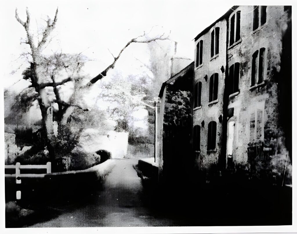
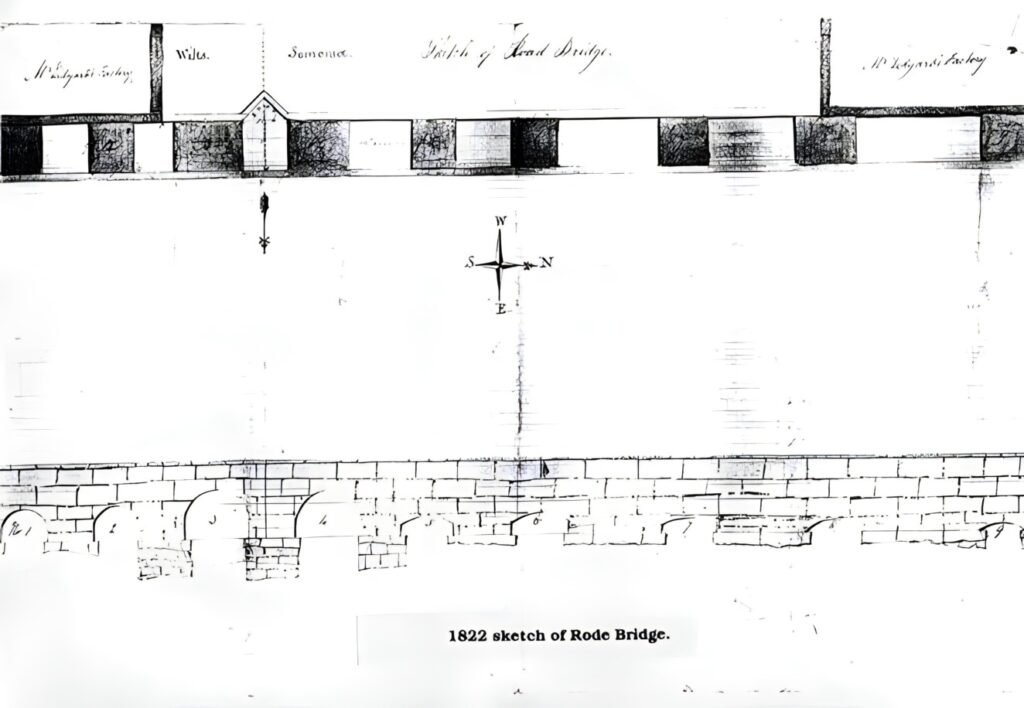
An 1822 sketch shows factories (mills) on the south side of the bridge at both ends.
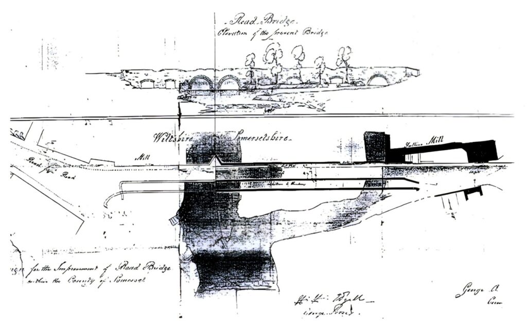
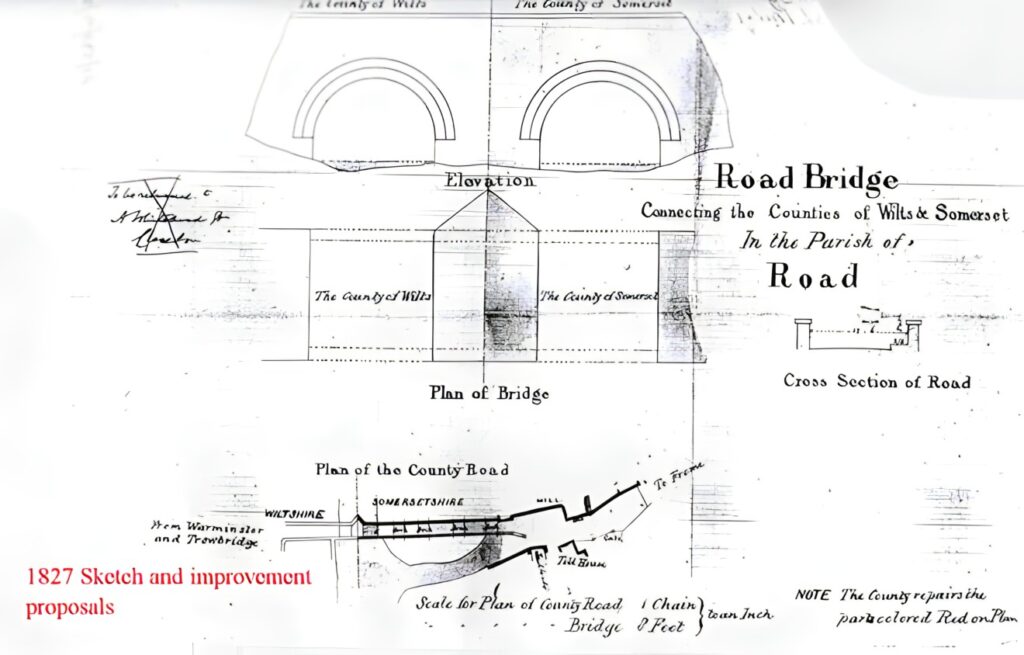
A plan was made to widen the bridge in 1827, but was not carried out. The plan shows the toll gate at the west end of the bridge
The cutwater between the two main arches of the bridge has been extended upwards to form a refuge for pedestrians. The refuge contains two old boundary stones.
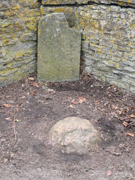
The large orange/brown boulder marked the pre 1937 county boundary between Somerset and Wiltshire. The upright grey stone has a vertical line down the centre of its face with NORTH BRADLEY engraved on the Rode Hill (east) side and ROAD on the Woolverton (west) side. This suggests it marked the boundary between the parishes of North Bradley and Road cum Woolverton (when Rode and Woolverton were administered as one parish). The Parishes of Road and Woolverton were united as Road cum Woolverton in 1738 and separated into the two civil parishes of Road and Woolverton in 1895. This would indicate that it was placed there before: 1895.
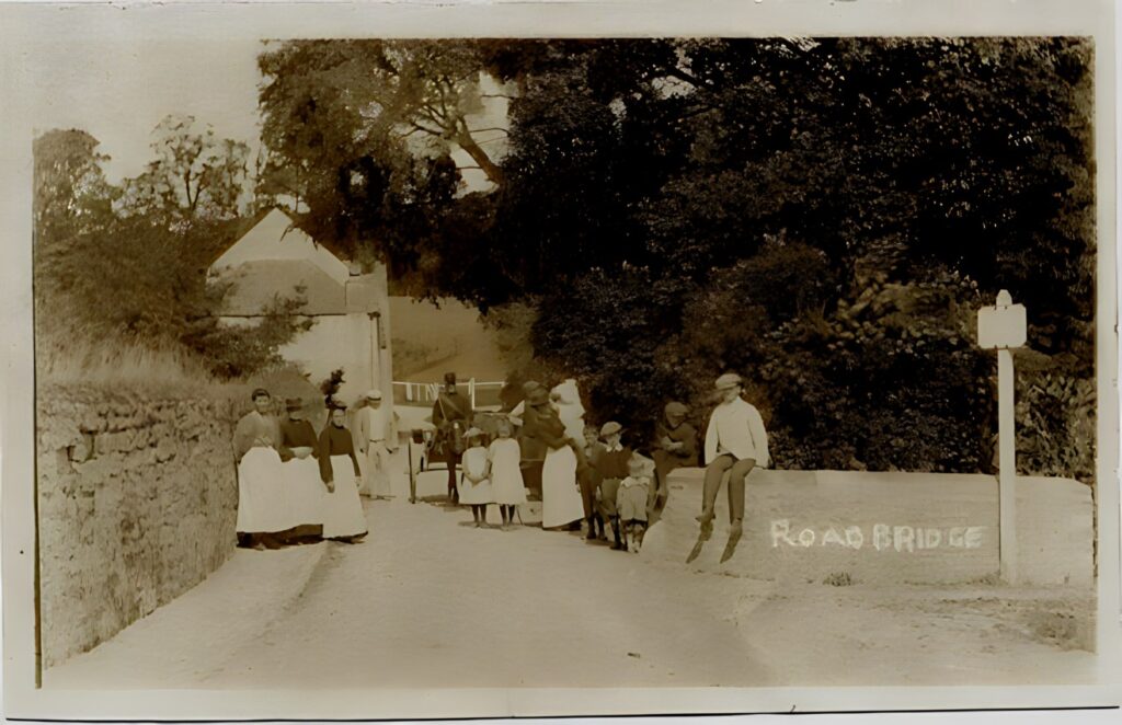
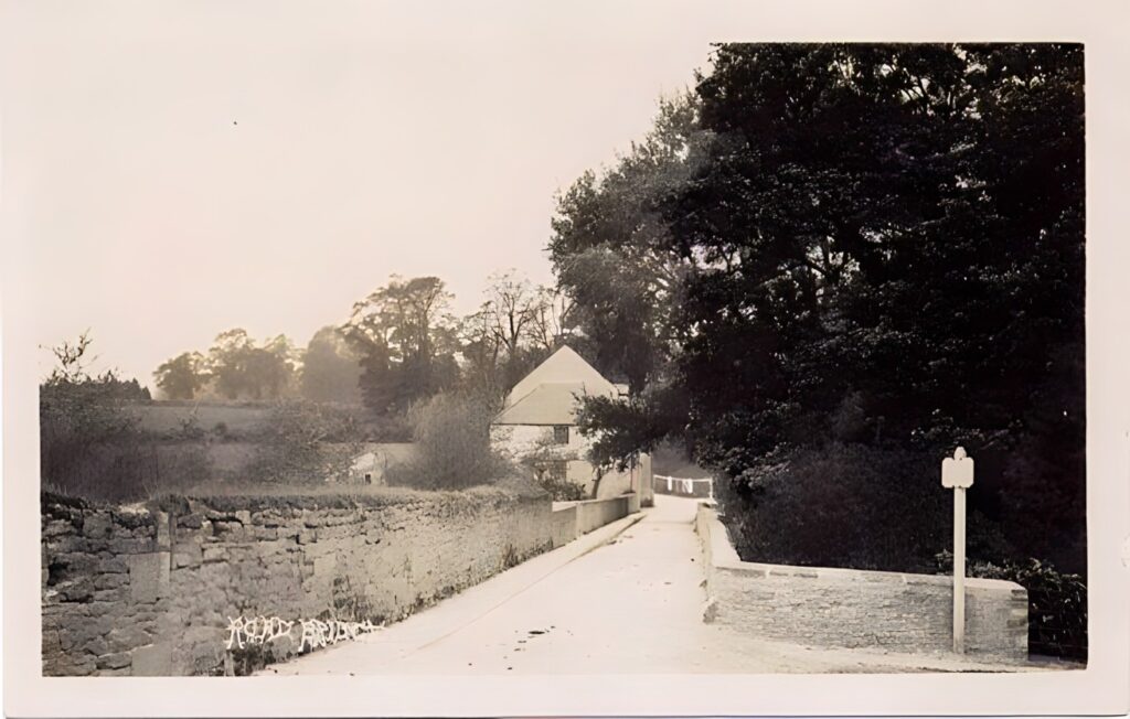
The spelling of the village name changed to “Road” in 1919.
On the outer face of the parapet around the refuge, facing directly upstream and about two feet below the capping stones is an undated stone plaque (below).
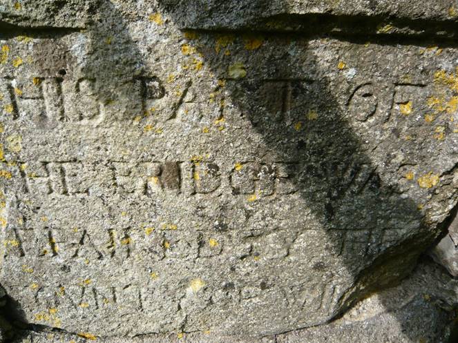
The engraving states: THIS PART OF THE BRIDGE WAS (R)EPAIRED BY THE (C)OVNTY OF WIL(TS)
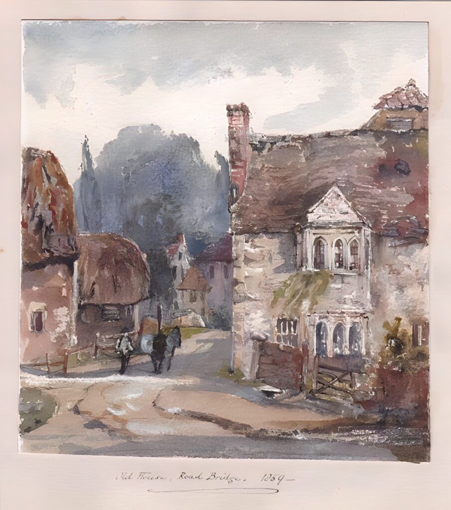
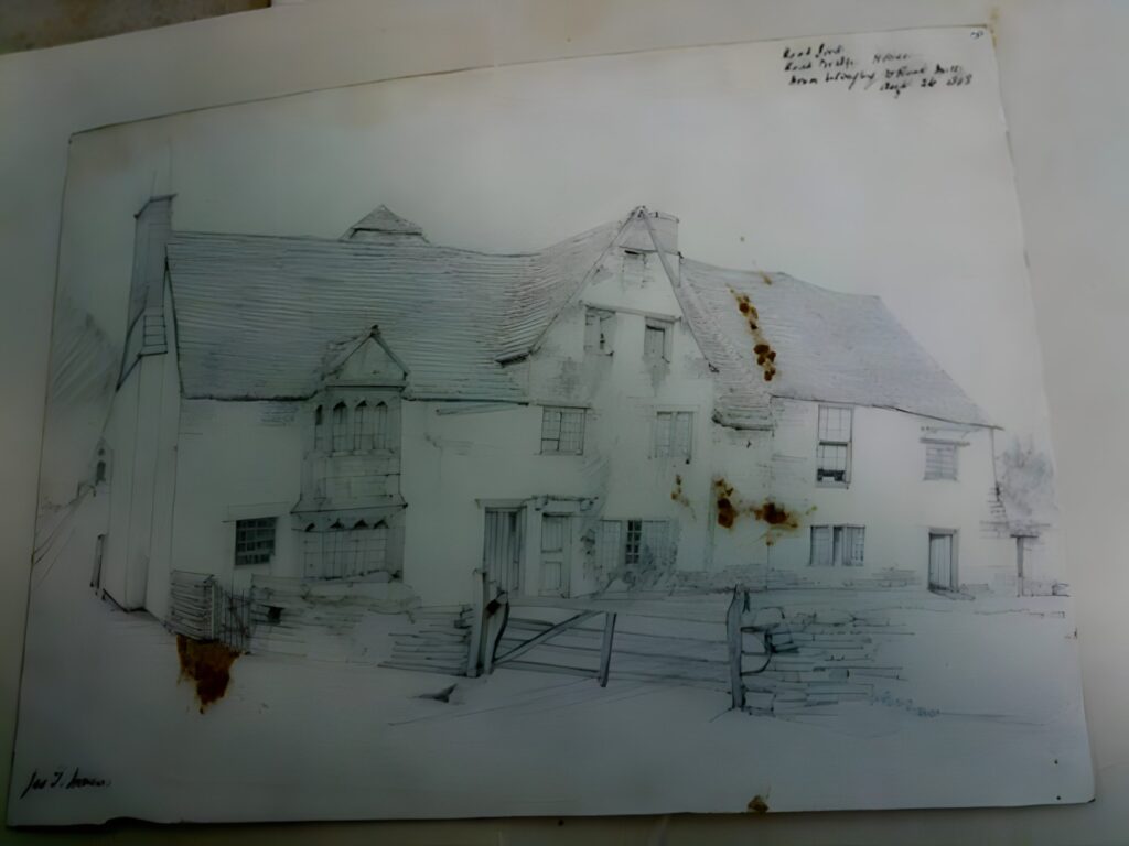
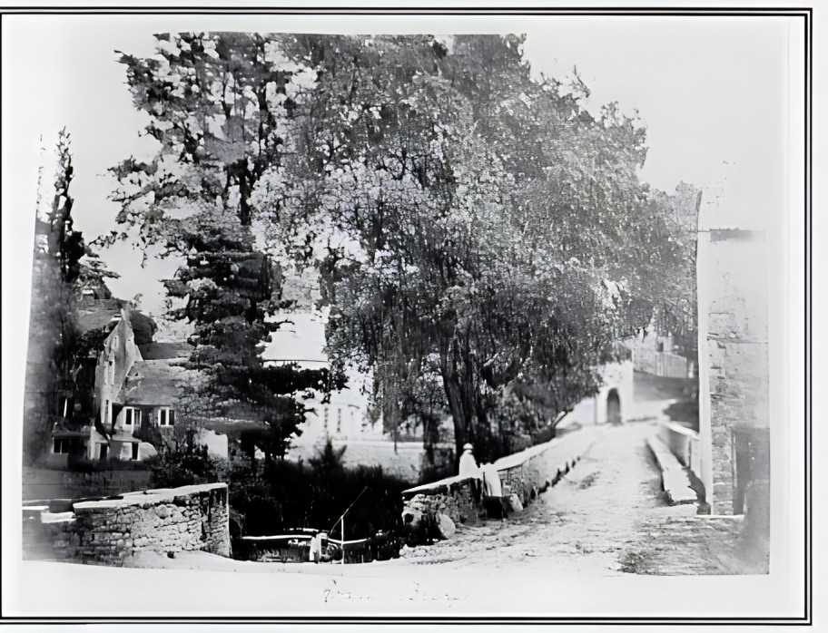
Note: In the painting above, left, the first house on the left was the toll house for the Black Dog Turnpike, shown on the 1827 plans of the bridge.