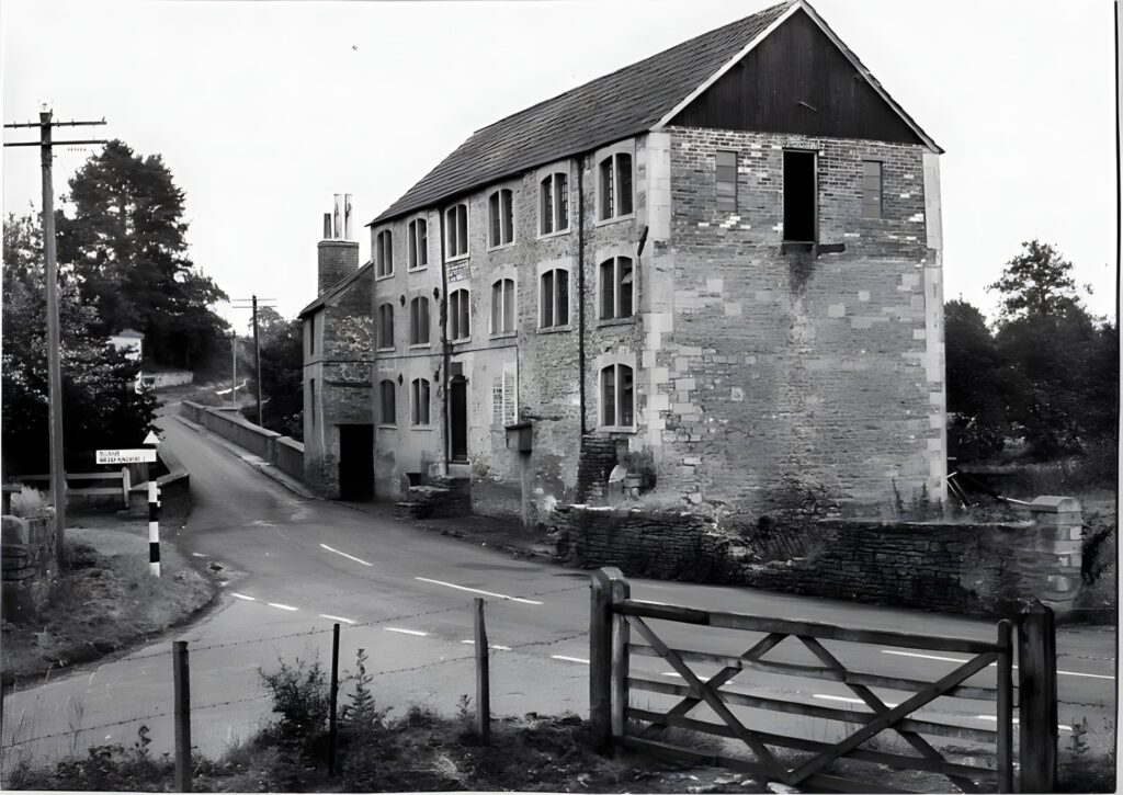
The Mill at Rode
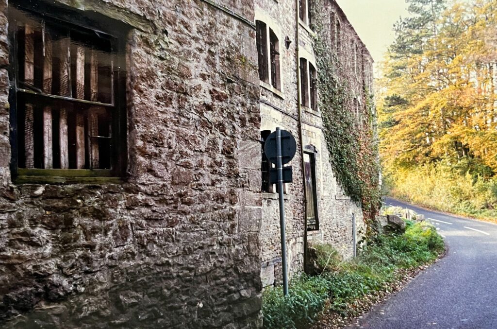
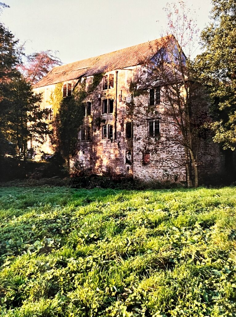
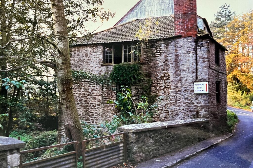
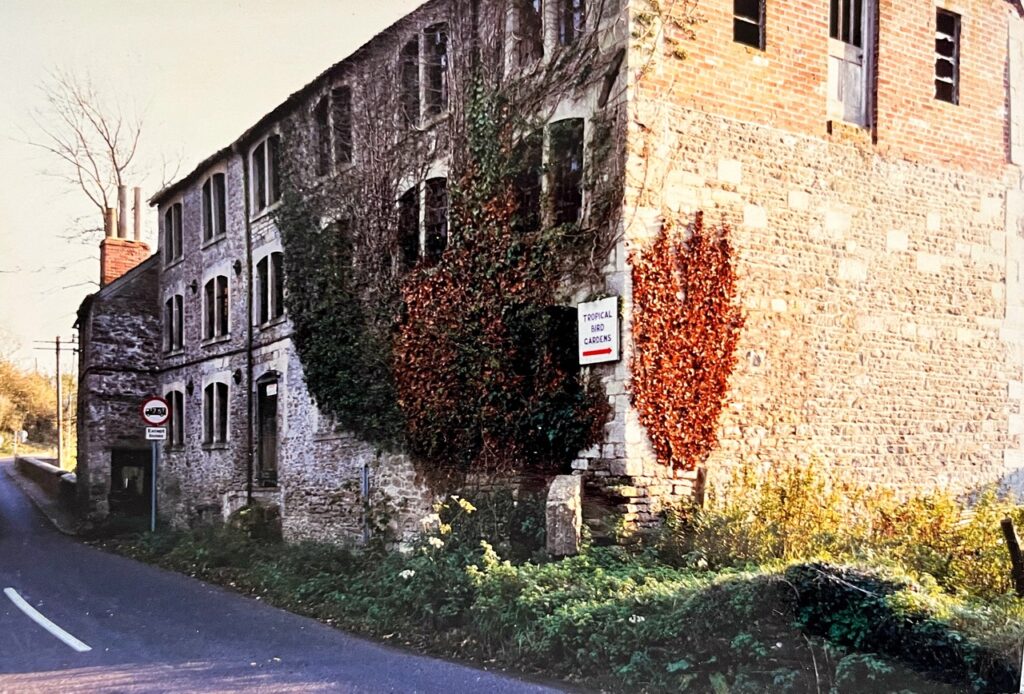
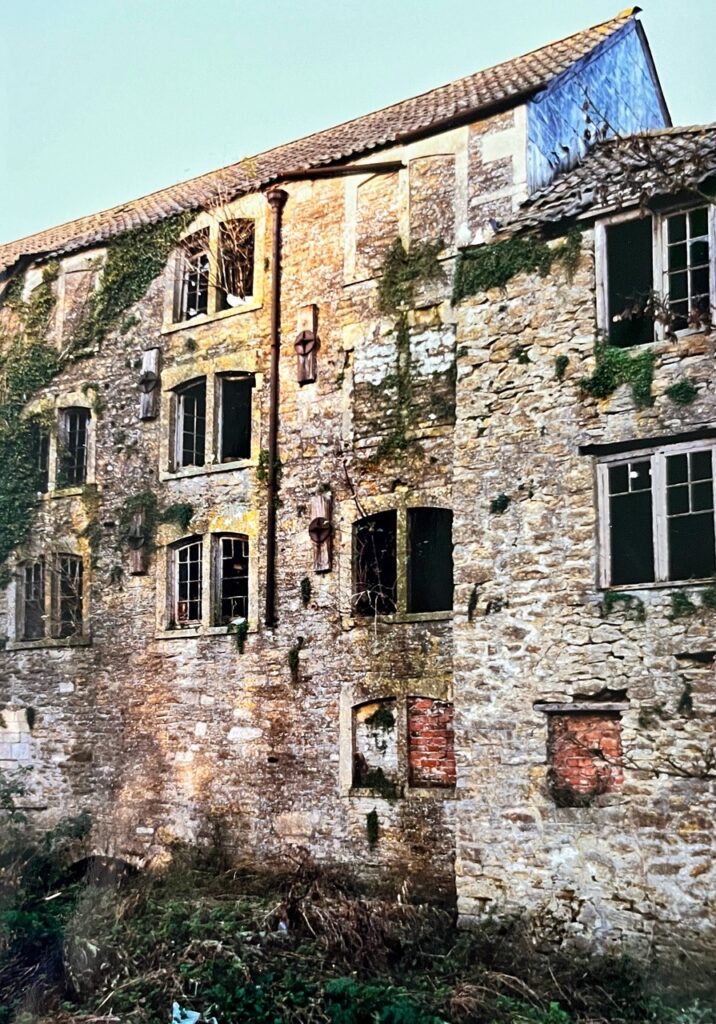
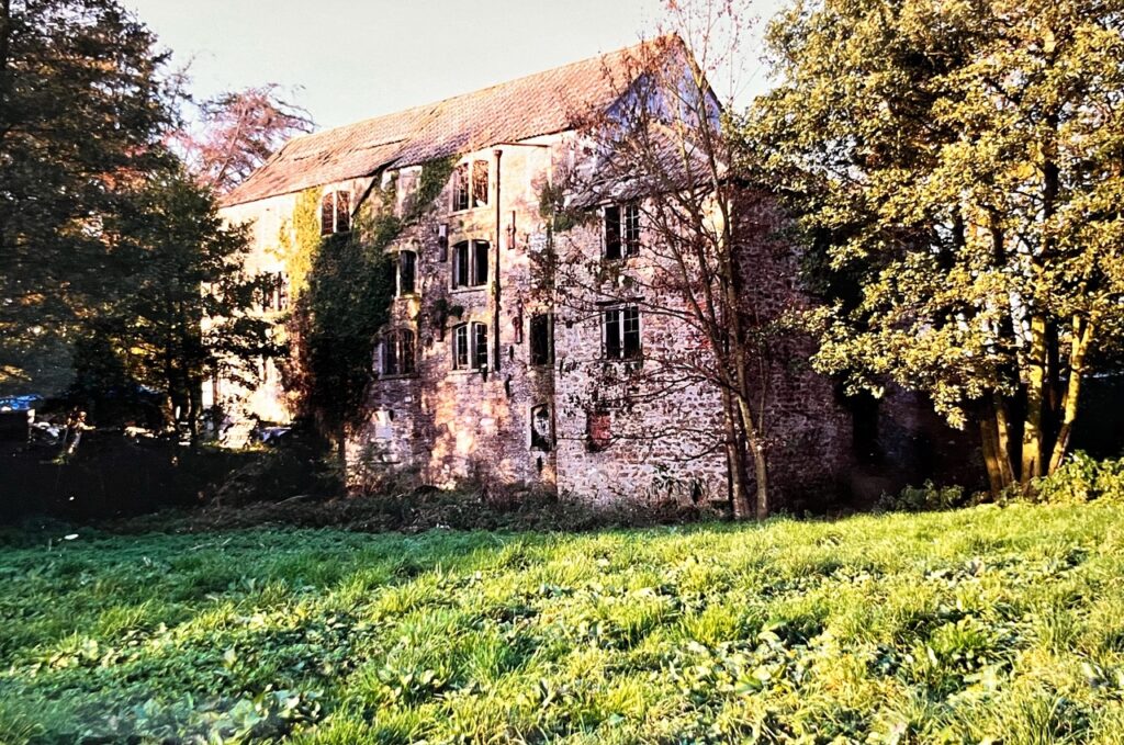
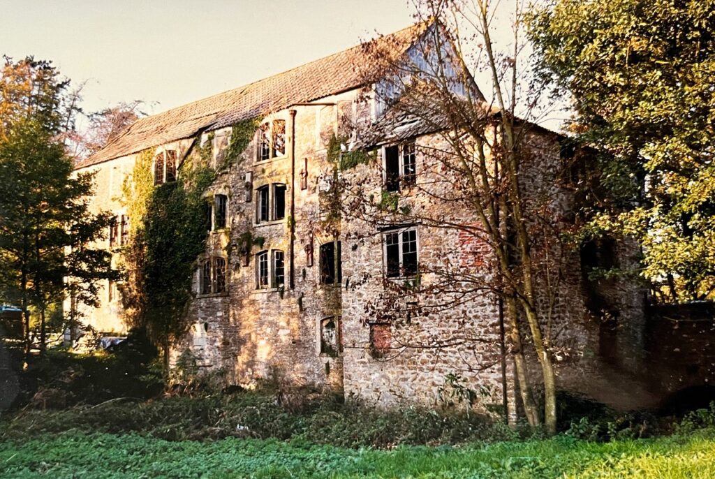
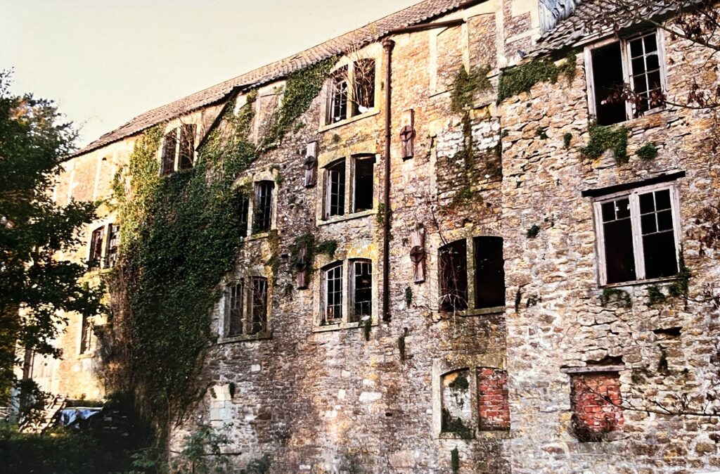
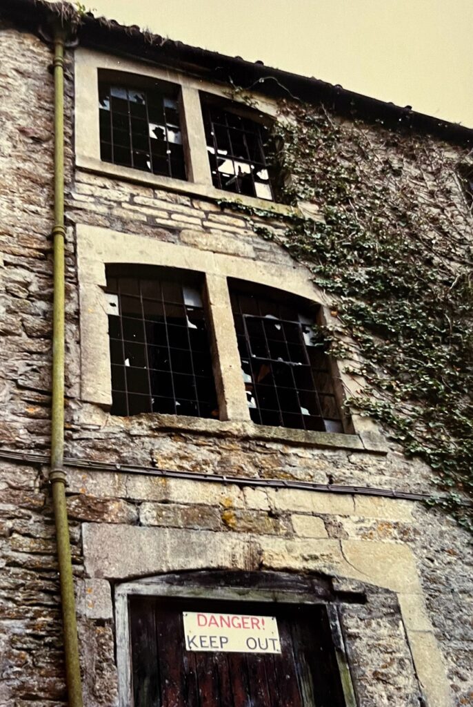
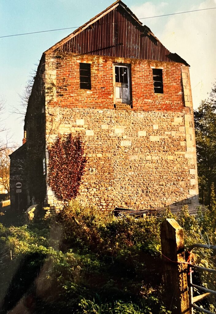
Domesday records Rode as having several mills and it is reasonable to assume that one of them was on the site of ‘The Mill’. The next reference to the mill is in the Hungerford Rent Rolls, which indicate that, in 1559, the Piard family leased a gryst (corn) mill and a tucking (cloth) mill from the Lord of the Manor, Richard Bamfield. The Piards still occupied the mill in 1623, although its ownership had passed to the Hungerford family. By 1686 Sir Edward Hungerford had gambled away all his estates, and the mill passed through several owners before being purchased by Henry Batten, a cloth-maker, in 1741. His great nephew, Henry Batten Pooll, took over the business in 1807 and added the current building as a cloth factory. The woollen industry declined and by 1850 the building was converted and used as a corn mill until 1897. By this time the mill was part of the Batten Pooll Rode Manor estate. When this was sold in 1955 the building became derelict until it was rescued in 1996.
The photographs below (courtesy of Sue French) show the derelict building in the early 1990s:
Mill Owners and Occupiers
Extracted from Ken Rogers’ Wiltshire and Somerset Woollen Mills
| Name | Description | Status | Date | Place | Mill | |||||
| PYARD family | Clothiers from Trowbridge | Tenants | 1559 | Rode | Rode Bridge Mill | |||||
| DAVIS, Henry | Fuller | 1715 | Rode | Rode Bridge Mill | ||||||
| BATTEN family | Clothiers of Rode | Owners | Early -mid C18 | Rode | Rode Bridge Mill | |||||
| LEDYARD, Thomas Whitaker | Clothier | Tenant | Early C19 | Rode | Rode Bridge Mill | |||||
| MOORE, James | 1841 | Rode | Rode Bridge Mill | |||||||
The detail below is courtesy of Harry Hopkins:
A Select History and Comment on the Mills at Rode Bridge for the years to 1900.
In 1086 Domesday said of the Mills at Rode:-
Robert has half a mill which pays 6s. Moses has the fourth part of a mill which pays 3s. Robert has the sixth part of a mill which pays 30d. Roger has two parts of two mills which pay 8s. Sheerwold has half a mill which pays 7s 6d.
It would be reasonable to assume that the Rode Bridge Mills were somewhere in the above description.
In Elizabethan times there were two small estates in Rode known as Bamfields and Stawels and included in these parcels were the Rode Mills and approximately 143 acres of land. The St. Maur family had owned Rode Manor since at least 1315 and when Sir William St. Maur died in 1485 his son William was the last surviving male issue but he had a daughter only who remained childless on marriage. She died in 1517 and so William (of Seymours Court) left the above two parcels of property to his two sisters. One of them called Margaret married a Bamfield and the other (Anne) married John Stawel. In 1564 the Webb family bought the moiety of Rode from the Bamfield family and in 1566 the Webb family acquired Stawel’s moiety. Presumably the Webbs also acquired Rode Mill. In 1588/89 the Webb family sold their property at Rode to the Hungerford family and it seems likely that that is how the Mills came to them.
Some of the land attached to the Mills however could have come to the Hungerfords from the Zouche family. By 1315 Rode Manor was owned by Laurence de St. Maur and by marriage of one of his descendants part of Rode went to the Zouche family. Alice St. Maur was fifth in descent from Laurence and in 1410 she married William Zouche bringing about 440 acres of Rode Manor to him. In 1551 and 1580 the Zouche family sold a large part of the Manor (their creditors were pressing) and in 1581 Sir Walter Hungerford of Farleigh Hungerford inherited a Rode estate from his grandmother (she was a Zouche) quite possibly because the Zouche family were in debt to the Hungerfords.
According to the Hungerford Rent Rolls the gryst mill on the west bank and the fulling mill on the opposite side of the river at Rode Bridge were working mills in 1559 and in the tenure of the Pyarde/Piarde family – they were clothiers from Trowbridge. This is confirmed by a Deed which reveals that in 1559 Margaret Pyarde held the Rode Mills by Indenture dated 1 Elizabeth (1558/59) from Richard Bamfield which described the premises as a tenement containing 1 hawle a buttery and a kitchen with 3 chambers over them tiled containing 4 fielde. Two other houses with lofts and a gallery tiled containing 4 fielde. One grist and tucking mill and a hayloft containing 3 fielde. (A fielde was a section of wall between columns or buttresses or the division of a vaulted or timber roof – a kind of bay).
The Hungerford Rolls disclose two distinct grants to the Pyarde family concerning the mills and provide information which supports the suggested descent of them to the Hungerford family. Both grants make reference to the Bamfields in connection with the mills but one also refers to the Lord Zouche as regards a field called Podgers which was attached to these mills. This grant instructed that a rent for that field be paid to the representatives of Zouche.
These grants are interesting (particularly the first one which describes the premises attached to the mills and confirms the 1558/59 Indenture details) and so they are reproduced in full:-
Margaret Pyarde widow Alex Pyarde and Anthony Pyarde her sons claim to hold for time of their lives in remainder one after another of the Grant of Richard Bamfield by Indenture dated 4 July 1558/9 the moiety of one tenement with appurtenances containing one hawle (hall) a buttery and a kitchen with three chambers over them tiled containing four fielde. Two other houses with lofts over and a gallery tiled containing four fielde. One grist/tucking mill with a chamber and a flock loft tiled containing two fielde. One tucking mill with a dry loft thatched containing three fielde. One bakehouse with a loft over containing one fielde. One stable with a hayloft containing three fielde thatched. A garden. An outer barton and a backside containing half an acre and half a yard. One rackham called the Great Rackham containing half an acre. One rackham called Little Rackham containing three roods. One close of pasture called Pogyers containing five acres. One close of pasture called Quarres containing three acres. One close of mead called Orttes Meade containing three acres. Twenty five acres of arable whereof in the Northfield eleven and a half acres and in the Southfield seven and a half acres. And in Wolvertons Field six acres and common in Rode Heath for so many beasts as they can winter with the fodder grown upon the premises.
The rent was 42s 4d and the tenants had to keep the premises in good repair at their own cost and so leave it at the end. The Lord gave them the right to take houseboote, millboote, ploughboote, fireboote and hedgeboote. Ploughbotewas the right to take wood in order to make or repair ploughs, firebote to remove wood for fuel and hedgebote the right to remove wood to build or mend fences. Housebote and millbote are thus self explanatory. There was the usual warning for non payment of rent – if unpaid by 20 days the Lord could distrain and if behind by a month and lawfully demanded and no sufficient distress then the Lord could re-enter.
The premises were valued at £26.13s 4d.
The second Grant said:-
Alex Pyarde Elizabeth his wife and Christopher their son claim for the time of their lives in remainder one after another of the Grant of Sir Walter Hungerford Knight by Indenture dated 20 May 32 Elizabeth (1589/90) the moiety of a tenement with appurtenances together with a grist mill and a tucking mill adjoining. A garden. An outer garden and backside containing in all half an acre and half a rod. One close called Great Rackham containing half an acre. One close called Little Rackham containing three rods. One close of pasture called Poygers containing five acres. One close of pasture called Quarres containing three acres. One close of mead called Ortes Mead containing three acres. Twenty five acres of arable land whereof in the Northfield eleven and a half acres and in the Southfield seven and a half acres and in Wolvertons Field six acres and common in Rode Heath for so many beasts as they can winter with the fodder grown upon the premises. Paying yearly of rent 42s.4d. besides the 5s. which was accustomed to be paid unto the Lord Zouche.
The same conditions applied as regards rent and repairs and for necessary repair purposes timber growing on the premises could be taken with the Lord’s agreement. Haybote, ploughbote, cartbote and firebote could be taken from the thorns, underwoods and shrouds of trees.
(In 1591 Anthony Pyarde appeared on a Roll which recorded fines of £20 a month for non attendance at a church or chapel (or a usual place of common prayer) and of rents due to the Crown from tenants to whom the estates of recusants had been put to farm. Pyarde’s entry was:-
Rode. Anthony Peyrd Fuller.
In 1590/91 the Hungerford Estate records show:-
Robert Hulbert holdeth by Indenture dated 20th. May 1589/90 of the grannte of Sir Edward Hungerford for the life of Elizabeth his wife and for the life of Christopher Piard her sonne the moietie of a tenement together with the moietie of a Grist Mill and Tuckinge Mill adjoyning. Of 1 garden 1 outer barton and backside containing half an acre and half a rood. 1 close called Rackham containing half an acre 1 close called Little Rackham containing 3 rods. 1 close of pasture called Podiers containing 6 acres. 1 close of pasture called Quarres containing 3 acres. 1 close of meadow called Orts Meade containing 3 acres and 25 acres with the appurtenances for ye yearly rent of 42s 4d and 2s 6d for Orts Mead.
Elizabeth 58
Christopher 28
Arable 25 acres
Meadow 3 acres
Pasture 9 and a half acres.
Rent 44s 10d
Value £13 6s 8d.
The same estate records also say that:-
Anthony Piard holdeth for his life only the other moietie of the forementioned premises by Indenture dated 4th. July 1559/60 of the grannte of Richard Bamfield Esq then Lord of the Mannor for the rents above specified.
Anthony Piard 60
Arable 25 acres
Meadow 3 acres
Pasture 9 and a half acres.
Rent 44s 10d
Value £13 6s 8d
A Survey made for the Hungerfords in 1623 showed that Hulbert and Pyarde were still there then – the details were the same as in the 1590/91 Survey except that Robert in 1623 held the premises on the life of his wife Elizabeth only – had Christopher died?
The Pyarde connection with the Rode mills lasted for many years. Margaret Pyarde (a widow) was a tenant in 1558/59 and her two sons Alexander and Anthony were also named tenants. Alexander married Elizabeth and they had a son called Christopher. When Alexander died Elizabeth married Robert Hulbert who took the premises in 1589/90 for as long as Elizabeth and her son Christopher lived. The Grant of 1558/90 shows that Elizabeth was then aged 58 years and Christopher 28 years.
Sir Edward Hungerford was the last Hungerford to occupy the Castle at Farleigh Hungerford and he was known as The Spendthrift. He dramatically reduced the vast Hungerford fortunes and was in such considerable debt that in 1686/87 he was forced to sell his estates. All the Hungerford property in this neighbourhood including Rode was bought by Henry Bayntun of Spy Park for £56,000 but before he paid the purchase money he died leaving a minor son. An Act of Parliament for disposing of the property was needed and the old Hungerford estates were sold over the years 1698 to 1703. Several people acquired various parts of Rode – the Houlton family taking much property in the vicinity of the Rode mills. (However it appears they did not acquire (or at least keep) the Rode mills because an agreement dated 1740 provided for Joseph Houlton to sell the premises on when he himself had acquired them. In 1737 Robert Houlton had sold Langham Farm and Mill to Mr. Andrews, a merchant from Bristol, who in the same year acquired the Manor of Rode. He built Northfield House (later ‘Road’ Manor) which was to pass into the Batten Pooll family. Perhaps Andrews also bought the Rode mills from Robert Houlton – they were close to Northfield House which was built on the site of a much older house).
In 1704 Henry Whitaker purchased land at the east end of Rode Bridge and erected a dye-house on it. Later documents mention dye-houses and so there seems to have been expansion. These buildings were custom built to finish off and dye cloth. Water power was needed to grind the dyeing material and water was needed for washing wool. Wool scouring was undertaken by dye-houses – wool was heated in stale urine and water in a metal furnace (in 1810 a furnace maker from Coleford in Somerset advertised his wrought iron furnaces as being cheaper than copper ones and named dye-houses where they were used including Rode) and then hung in running water to clean it. Then the wool had to be dried either by natural means or by the use of a fire or air stove. Rode had air stoves and the building at the eastern end of the bridge with large circular openings at the top could well have served this purpose. A Sun Insurance Policy dated 1750 specifically mentions an air stove at Rode Bridge.
Henry Whitaker remained in business until about 1731. (In 1715 Henry Davis was operating as a fuller at the Rode mills but I have not been able to establish any business relationship with Whitaker. Deeds dated January 16th and 17th 1715 refer to Davis of Rode Mill in the County of Somerset so it appears he would have worked at the western end of the Bridge for Somerset was at the west end and Wiltshire at the east end. The Deeds refer to Rode Mill and so there might have been only one mill operating at the west end in 1715.
In 1727 Inspectors of Cloth were appointed to the Rode Bridge premises perhaps giving some indication of the scale of activity there.
Henry Whitaker made his Will on 11th. January 1729 and described himself as a Dyer. Part of it said:-
I give and devise unto my son William and his heirs for ever the house at Mogghill that Jeremiah Lye liveth in and the house that Stephen Messiter liveth in and the grounds called Jennitts Hill and Scammells Mead and Dyehouse to the said Estate and the Furnaces Pump and Vatts with all the utensils of Trade and all sorts of Dye Stuff I have.
In 1736 Whitaker’s son who lived at Trowbridge let the dye-house to Thomas Whitaker and Robert Everett who were trading as a partnership and in 1762 the lease was in the hands of Thomas Whitaker who was described as a clothier and dyer. A 1757 insurance policy reveals that the property included two dye-houses, a stove, two stove houses, an air house and workshops and a shear shop.
In 1764 there was a great fire at the mill premises of Thomas Whitaker of Rode where the damage ran into several thousand pounds – a huge sum in those days. Newspaper reports called Whitaker one of the greatest clothiers and most noted blue dyers in all the West of England. Unfortunately the reports give no further detail of the fire and I have been unable to locate any other records but possibly the fire was at the Rode Bridge premises where a stove was in use.
On 12th. July 1768 Thomas Whitaker of North Bradley (the eastern side of Rode Bridge was then in that parish), a clothier, bound himself to the Clerk of the Peace of the County of Wilts for £40. The Bond stated that the south east side of the Bridge plus 100 yards in the County of Wilts should be repaired by the inhabitants of that County and that had recently been done. At the Quarter Sessions held at Warminster Thomas Whitaker proposed to the Court that he would keep the above part of the Bridge in good repair at his own costs for 10 years for a yearly sum of 20 shillings. The Court accepted Thomas Whitaker’s proposal. Did Whitaker see a need for a decently maintained Bridge right next to his business interests?
During the above comings and goings Rode Manor was in 1737 acquired by a Bristol merchant named Mr. Andrews (he built Northfield House later Rode Manor). His acquisitions included Langham Mill but I have not been able to ascertain if the Rode mills were also included. However in 1741 Joseph Houlton of Farleigh Hungerford acquired Rode mills (and other Rode property) from a gentleman called Mr. Mayhill and an apothecary named George Stuart – no doubt nominees. In the same year Houlton sold the mills to Henry Batten of Rode, a drugget maker. An agreement to purchase the Rode mills had in fact been made between Houlton and John Batten the previous year – on 16th. March. The Agreement said:-
Agreement of purchase between Jos Houlton Esq and Mr. John Batten for Rode Mills etc 16th. March 1740.
Memdum the 16th. March 1740. It is agreed between Joseph Houlton of Farleigh Hungerford in the County of Somerset Esq and John Batten the elder of Rode in the County aforesaid Clothier as followeth that is to say The said Joseph Houlton is with all convenient speed (after Mr. Mayhill shall grant and convey to or in trust estate for the said Joseph Houlton and his heirs an absolute of inheritance in fee simple of the premises hereinafter mentioned) Grant and Convey to the said John Batten and his heirs an absolute estate of inheritance free from incumbrance of and in All that Messuage or Dwelling House and the Grist Mill thereto adjoining now in the occupation of William Whitaker and all that Fulling Mill adjoining to the said Grist Mill late in the occupation of Peter Crabb deceased together with the two little parcels of meadow near to the said Mills called the Rackhams containing in the whole about one acre and three quarters together also with the ruinous building near adjoining to the said Whitaker’s Dwelling House called Salters House and the Garden Stables and Outhouses thereto belonging or adjoining. Excepting out of the Grist Mill and building thereto belonging to the said Joseph Houlton and his heirs the Chamber over the same Mill called the Blow Chamber now occupied by William Crabb.
In consideration whereof the said John Batten agrees to pay to the said Joseph Houlton the sum of four hundred pounds when such conveyance shall be com-pleted together with interest for the same from the twenty fifth day of March instant and to bear the charges of all proper conveyances and to enter into proper covenants that he the said John Batten and his heirs and assigns shall at all times forever hereafter at his and their costs maintain and keep in good repair the roof of the said Grist Mill over the said Chamber called the Blow Chamber.
In witness whereof the said parties have hereunto set their hands.
The said John Batten agrees that William Hole shall become tenant of the Grist Mill and Lower Paddock and the Stable now let with the Grist Mill upon the same terms agreed to between the said Joseph Houlton and William Hole.
John Batten and Joseph Houlton signed this Agreement which was witnessed by G. Hussey.
The Agreement seems to have been in respect of premises on the west end of the Bridge – in the County of Somerset. The actual Sale Contract certainly refers to the premises as being in the County of Somerset.
The 1740 Agreement is interesting for it reveals:-
In 1740 (and probably before) the grist mill (and house adjoining) was in the occupation of William Whitaker – no doubt of the same family as those at the other end of the Bridge;
The fulling mill adjoined the grist mill and had been in the occupation of Peter Crabb deceased;
In 1740 there was a ruinous building called Salters House adjoining Whitaker’s house. Stables and outhouses were part of the complex;
There was a chamber called the Blow Chamber over the grist mill which was occupied by William Crabb;
There was a new tenant (William Hole) going into the grist mill in 1740/41;
Houlton had agreed to sell the Rode mills before he had formerly acquired them.
The Indenture or Sale Contract was dated 9th. December 1741 but between Joseph Houlton and Henry (not John) Batten. He was described as a Druggetmaker and paid Houlton £540 for All that messuage tenement or dwellinghouse situate lying and being at or near Road Bridge in the said County of Somerset now in the occupation or possession of William Whitaker as the same is now severed or parted from the messuage or dwellinghouse thereto adjoining now in the occupation of James Crabb as tenant to the said Joseph Houlton. And also all that Grist Mill now in the occupation of the said William Whitaker near adjoining to the said first mentioned messuage. And all that Fulling Mill adjoining to the said Grist Mill late in the occupation of Peter Crabb deceased and now of James B….(Deed eaten away).
And also all those two paddocks or parcels of (unreadable) ground near adjoining to the said Mills called or known by the name or names of the Rackhams containing by estimation two acres be they more or less. And also all that ruinous or decayed building near adjoining to the said dwellinghouse called or known by the name of Salter’s House and the orchard and garden thereto adjoining. And also all that close of pasture called or known by the name of Whitefield otherwise Perry Hill containing by estimation three acres be the same more or less lying and being in the Northfield of Road aforesaid abutting westward to a ground of the said Henry Batten called or known by the name of Summer Leaze and eastward to a ground of John Batten called or known by the name of Quarr Close. And also all that close of meadow or pasture ground called or known by the name of Fowle Mead containing by estimation three acres be the same more or less abutting on the south west part thereof to lands late of Roger Stevens but now of William Tucker and eastward against a little lane leading into the road leading from Road aforesaid to Tellisford in the said County of Somerset.
The Indenture went on to say that the above premises (together with others) were conveyed to Joseph Houlton on 10th. July 1741 – the other parties being Messrs Mayhill (gentleman) and Stuart (apothecary) The document also mentioned the Blow Chamber over the grist mill occupied by James Crabb and an empty room over that reserving those areas from the Release and also saying that Crabb and any other tenants and occupiers for the time being for ever were to enjoy the free and uninterrupted use at all times of the watercourse or fry lately made leading from the dwellinghouse of the said James Crabb in by and through that part of the dwellinghouse in the occupation of the said William Whitaker which was sometime since an entry or passage to the dwellinghouse of the said James Crabb from Road Bridge.
The Indenture ended with Henry Batten promising at his own costs to maintain and keep in good repair the roof of the said Grist Mill over the said chamber called the Blow Chamber…And it is…agreed between the said parties to these presents that the partition above stairs now standing and being between and dividing the said dwellinghouses of the said James Crabb and William Whitaker shall from time to time and at all times for ever hereafter be repaires and maintained at the equal expense of the said Joseph Houlton…and of the said Henry Batten….
The above fields were situated on the western side of the Bridge and as late as 1768 Henry Batten was acquiring several other fields on that side. Peter Crabb who was dead by 1740 had occupied the fulling mill and he too occupied several lands at the west end.
The Minutes dated 19th. May 1772 of the Manor Court for the Hundred of Whitway with the Manor of Road and Langham include the following presentment:-
Also we present that the Gate and Rails at Road Mill are out of repair. Ordered that the same be repaired within a fortnight by the person or persons who of right ought to repair the same under the penalty of £5 each Defaulter.
The 1559 Hungerford Rent Rolls reveal that there was a grist or corn mill on the west bank and a fulling mill on the opposite side of the river at Rode Bridge. Later documents show the grist mill and fulling mill to be ‘adjoining’ and in 1740/41 the grist mill was adjoining the house occupied by William Whitaker and the fulling mill described as adjoining the grist mill. Andrews and Dury’s Map of 1773 is interesting because it shows the Rode Bridge and mills and reveals three mill premises – identified by ‘water-wheels’. Although this map was not supposed to be a precise document it does show the locations of the mill buildings including the dye-house south of the Bridge on the east bank of the river which was built about 1704/5 by Henry Whitaker. Note the mill on the west side of the Bridge – did a building here once extend so far east or is the map illustrative only? Andrew and Dury’s map does not appear to include unoccupied buildings because some of the premises recorded in the 1757 Insurance Policy (see above) are not mapped. They were situated on the bend east of the Bridge and of course are still there today. There was at some stage a fulling mill on the mill-stream north of the bridge (western side) but this is not shown on the above 1773 map either because it was unoccupied, did not exist in 1773 or was too far into Somerset.
A 1782 map of eastern Somerset features Rode Bridge but unfortunately there is not sufficient detail to pick out the mill buildings. It is however produced for information.
A 1792 map of Rode Common, part of which is reproduced, gives some basic detail of buildings on the east side of the Bridge but it is of limited use because only occupied premises appear to be mapped out. (The map is nevertheless interesting showing the extent of development around and about Road Bridge Road.
An 1807 North Bradley map gives much more detail for the eastern side of Rode Bridge and the mill complex there. (the side of the Bridge in the Wilt-shire). The long narrow leat running from the river to the dye-houses (numbered 958 on the Map) was fed through the first two arches of the Bridge. (Note the building north of the Bridge in front of the Miller’s House). A Survey and Valuation of this part of the map says:-
Number 957.
Mansion House, Outhouses and Garden owned by Elizabeth ‘Whittaker’ and occup-ied by T. W. Ledyard measuring 2 roods and 16 perches.
Numbers 956 and 958.
Dye-Houses, Workshops, Barn and Yard measuring 2 roods. Owner and Occupier as above.
Note the layout of the Mansion House – darker buildings indicated living accommod-ation and although Ledyard ‘occupied’ the premises he himself did not live there. He built Rode Hill House (now Langham). No doubt the mill manager lived at the Mansion House (which in later years and then for many years became the laundry for Rode Manor. The buildings adjacent to the Mansion House had contained the Counting House and these were to become the workshops for the Rode Manor Estate carpenter called Mr. Prescott).
There is a map of Somerset dated 1822 which does illustrate the mills at either end of the Bridge (by a water wheel symbol) and this is reproduced under.
Ledyard’s interests in the Rode Bridge premises ceased in 1835 (following his death) and the buildings were advertised as available for letting – the dye-house and drying stoves where a most profitable clothing and dyeing business has been carried on for many generations.
By 1835 ownership of the above numbered premises had passed from the Whitaker family to the Batten Pooll family and the building numbered 958 was soon to become a ruin. The Batten Pooll family now had control of both ends of the Bridge.
The 1846 Tithe Award for North Bradley reveals the development which had taken place at the eastern end of the Bridge since 1807. Compare the layout of numbers 958 (1807) and 99B (1846) and note the change in layout and usage of the buildings north of the Bridge on the eastern side. This Award confirms that Henry Batten ‘Poole’ and Thomas ‘Poole’ owned the lands and premises numbered 99A, 99B, 106A, 106B and 107 as well as other local properties. The Schedule to the Award says about the above numbered properties:-
Landowners Henry Batten Poole Thomas Poole
Occupiers No 99A George Osborne for Aust Meadow, pasture
No 99B Void Buildings in ruins. Formerly used as a Factory
No 106A House, Offices Yard etc
No 106B George Osborne for Paddock
No 107 Henry Batten Poole and Thomas Poole for Hilly Ground and Outbuildings
The void buildings in ruins were demolished sometime before 1884 as they are not shown on the Ordnance Survey map for that year.
As for the western side of the Bridge the 1790 Poor Rates for Rode show Henry Batten as owner and that John Ball occupied part of the mill. Often the Poor Rates, Church Rates and Land Tax Assessment records just show a Batten/Pooll as the owner and the occupier of the Rode mills but obviously there were tenants and workers there too.
By 1808 as well as the grist mill and fulling mill at the western end of the Bridge there was a factory (now the Mill Restaurant) and this factory must have been built on the site of a former mill if reference is made to the 1773 Andrews and Dury map. In 1808 the buildings were insured through the Sun Insurance Company for £340. The stocks, wheel and gearing were insured for £100. (At this time the fulling mill (and factory) was let to Thomas Whitaker Ledyard, the prominent clothier mentioned above and the buildings were largely used in connection with the operations at the Scutts Bridge Factory until about 1835). The Sun Insurance Policy was dated 27th. February 1808 and the policy holder was Henry Batten Pooll of Rode. His Woollen Factory, Fulling and Grist Mill adjoining situated at Road Bridge, Stone and Tiled with No Stove therein was insured for £340. The Stocks, Water Wheel, Gear Work and running Tackle within occupied by T. W. Ledyard was insured for £100. A Dwelling House adjoining the Grist Mill and occupied by Joseph Wilton, Stone and Tiled was insured for £60 and The Brew House, Barn, Straw House and Stable near but not adjoining the aforesaid Stone and Thatched was insured for £200. The total insured sum for Batten Pooll’s premises at Rode Bridge was therefore £700.
Mention has been made (see page 4) of the advertisement in 1810 for metal furnaces. The newspaper said:-
George Jefferies takes this opportunity of informing Dyers, Brewers and others who have occasion for large or small FURNACES that he will undertake to supply them with wrought IRON FURNACES of any shape or size that shall answer their purpose equally as well as Copper ones and will only cost about one third of the price. Anyone can judge how much will be saved in the interest of money in a very few years in laying out fifty pounds in so cheap an article as Iron instead of three times that sum in so fluctuating an article as Copper. The following Gentlemen
Allen & Co, Frome John Sheppard, Frome
Wm Rossiter, Frome Jas Slade, Clothier, Frome
John Jukes, T. W. Ledyard, Road Bridge
(and others)
who have honoured him with their names as a recommendation (and several others) have made trial of these Furnaces; some of them have been in use ever since October 1806 are as good now as they were when new and most likely will endure as long as copper….
The woollen factory above was a building constructed to use waterpower to drive machinery and could have been built because the fulling mill just downstream was using its maximum water power carrying out its prime function – perhaps the fulling mill could not operate efficiently if its power was partly diverted. This could be a reason why the woollen factory had what must have been an undershot wheel for the fall here was quite small. The factory might have contributed to the eventual demise of the fulling mill downstream by virtue of its position and use of power. In 1822 this factory was a Manufactory but by 1827 it was being used as a fulling mill. The fulling mill downstream remained there for many years after ceasing work and probably just became a ruin before it was demolished.
In 1828 and 1829 repairs were undertaken to Rode Bridge (I have a document dated 1725 describing the part of Rode Bridge lying in Wiltshire as now very much out of repair and much the same is said in several documents for later years) and in 1849 a portion of the parapet was hit down by a horse and carriage coming in contact with it. The parapet was rebuilt by July 1849. In 1882 and 1883 there was correspondence over the dilapidated part of Rode Bridge lying in Wiltshire. The Somerset section had been repaired and R. P. Batten Pooll complained to the Wiltshire Council about the dangerous state of the Wiltshire side. At first the Council denied responsibility but Batten Pooll persevered and finally the Council undertook the repairs because the Bridge was a County Bridge (joining Somerset and Wiltshire). Their researches revealed that for centuries it had been a raised causeway for foot passengers to use in times of flood. I mention all this because att-ached to some of the correspondence are sketches and plans of the Bridge dated 1822 and 1827 (which are in themselves interesting) and some of these maps show part of the outline of the mills at either end of Rode Bridge – as well as the turnpike house.
A report attached to the 1822 sketch says:-
Is a long Bridge over a series of rough stone arches two of which only admit the regular stream. A cut water against the stream forms a recess in the Bridge in the face of the south west cant of which is a tablet stating that this part of the Bridge was repaired by the County of Wilts. The road between the parapet walls is only twelve feet wide three of which are flagged and used as a pathway.
The Bridge is by no means in bad repair. The Wiltshire part requires pointing and a few holes stopped in the face of the work. The narrowness of the Bridge is the principal objection; many accidents are described as having occurred from this cause as two Carriages cannot pass each other on the Bridge and this being a space of 277 feet renders it not only awkward but dangerous.
The arches no 1 and 2 lead to Mr. Lidyard’s dye-house situated at the opposite side of the Bridge. At flood times these are described as being filled to the top of the arch.
Nos 3 and 4 are the arches that receive the stream.
Nos 5, 6 and 7 are only useful at high water. At present they are quite dry.
No 8 has a small run of water.
No 9 is used as a thorough for the use of Mr. Lidyard’s Manufactory on the opposite side of the Bridge.
The sketch is attached showing the position of Ledyard’s two ‘Factories’ on each side of the riverbank south of the Bridge.
The 1827 sketch and plans are very interesting – they show the Bridge as it looked in 1827 and the proposals for improving it (the Somerset side at any rate). Today the Bridge is still 12 feet wide (notice that on the 1822 sketch there are 9 arches and on the 1827 sketch 8 arches). In 1827 the dye-house on the east bank south of the Bridge is described as a ‘mill’ and the factory at the other end as a ‘fulling mill’.(As a matter of interest note the Toll House, Toll Gate and the dam north of the Bridge).
A sketch of the proposed new Warminster Road (the A36) made by the Black Dog Turnpike Trust in 1833 shows just one mill building at the western end of Rode Bridge and no doubt this was because the main aim of the plan was to illustrate the Turnpike’s interests only.
Ledyard died in 1835 and he left his family in severe financial difficulty due to the decline of the woollen trade. European clothiers had been protected by their Governments imposing high taxes or tariffs and Parliament itself taxed foreign wool all which led to a depression in the trade. Parliament eventually removed the home tax but business did not improve as expected and returns were poor. Ledyard had hoped the removal of the tax would stimulate demand but the demand was not sufficient to improve his lot. Diaries of the Bunn family of Frome reveal a little about Ledyard. An entry dated 15th. March 1800 says…This morning Jane and Arundel returned from Bath after an absence of one month and brought the intelligence that their cousin Anne Sheppard is engaged to Mr. Ledyard of Road who has a hand-some fortune and has just built a very good house. He bears an excellent character and as they are both disposed to lead a religious life I sincerely hope the blessing of God will attend them. A diary in 1835 made mention of Ledyard’s internal disease which the writer said he bore with fortitude knowing that his end was near and after his death another diary speaks of the real financial difficulties Ledyard’s family was left in and the hundreds of workers at risk. Ledyard’s memorial in Rode Church is reproduced under.
Following Ledyard’s death the Rode Bridge premises were advertised for letting and in the Salisbury Journal dated 21st. December 1835 the following appeared:-
To be Let and entered on at Lady Day next – All those extensive and commodious premises situate at Road Bridge in the County of Wilts where a most profitable clothing and dyeing business has been carried on for many generations and late in the occupation of T. W. Ledyard Esq deceased consisting of a good dwellinghouse and garden, a house for foreman, three cottages for labourers, blue and furnace dyehouses, drying stores etc, counting house, coach house, stables, cart house and barn, with or without 10 acres of water meadow and pasture land.
N.B. The Blue Vats and Furnaces may be taken at a valuation.
For further particulars apply by letter to H. B. Poole, Esq., Road, Somerset.
As the premises were in the County of Wilts they must be those at the eastern end of the Bridge – some of which were in a ruinous state in 1846 according to the North Bradley Tithe map.
In 1835 the fulling mill on the western side of the Bridge contained two pairs of stocks with capacity for a further three and in 1839 was occupied by James Moore.The 1839 Tithe Award shows Henry Batten Pooll owner of the Rode mills and James Moore as occupier of the fulling mill (mapped as number 208). A copy of part of the Tithe map shows the fulling mill to have been north of the Bridge but nothing now remains except for a little stonework in the bank. If the 1827 sketch is accurate and the factory at the west end of the Bridge was by then being used as a fulling mill then presumably during that period there were two fulling mills on the west side that is if the fulling mill downstream from the factory was then being used as such. Quite possibly the factory (now the restaurant) numbered 214 on Rode’s 1839 Tithe map was included with the description of number 208 because there is no description for number 214 itself on the Schedule accompanying the Tithe map. However number 208 is certainly described as a fulling mill and for the sake of clarity the Schedule describes the properties around the ‘factory’ or mill as:-
No Owner Occupier Description
185 John Houlton William Woolley Garden at Road Bridge
209 John Houlton Fanny Wilkins House and Garden
210 John Houlton John Millett House and Garden
211 John Houlton William Woolley Yard at Road Bridge
212 H. B. Pooll George Osborne Upper Rackham
214 ————– —————– ———————
213 (Water course)
207 H. B. Pooll George Osborne Grist Mill Garden
208 H. B. Pooll James Moore Fulling Mill and
Lower Rackham
206 Ledyard de’cd George Osborne Walkers Paddock
The 1846 North Bradley Tithe map shows the buildings on the west side of the Bridge (the toll house, the residential houses adjoining the mill, the factory or mill and workshop) but no fulling mill downstream. One would have expected to have seen this on this map had it been still there in view of the detail given for the western side but it is possible that the North Bradley map omitted this downstream building because it was downstream and away from the Bridge. It does seem however that the North Bradley Map is more accurate than the Rode one. The 1822 report mentioned above refers to arch number 8 on Rode Bridge having a small run of water and this is shown on the 1827 sketch also mentioned above. The 1839 Tithe map for Rode shows nothing in respect of this water course but it is shown on the 1846 North Bradley Tithe map.
Number 207 on the 1839 Rode map is described as a grist mill garden and it is certainly possible that at one time the grist mill and fulling mill shared the same building – various old documents have described them as ‘adjoining’.
The Electoral Roll for 1840/41 reveals that Moore lived at Farleigh Hungerford and that he occupied a house and mill described as Road Bridge Mill. (The 1851 Census for Farleigh Hungerford discloses that he occupied the Farleigh factory and was married and aged 53 years. He had been born in Nunney).
The only reference I have been able to find in the 1841 Census which might relate to the Rode mills is for a family living at Road Bridge the head of which was James Burridge aged 35 years and a Fuller. Others lived in houses at Rode Bridge but they were agricultural labourers or had occupations not connected with the mills. We know that by 1841 Batten Pooll owned the premises on both sides of the Bridge and he advertised in newspapers for people to rent the Rode Bridge mill buildings. It is evident that even before Ledyard died in 1835 the woollen industry in Rode was rapidly declining despite attempts to suggest otherwise in advertisements to let.
What is also known is that in 1840 only one factory was working in Rode. A Report to Parliament in 1840 said The Parish of Rode near to or adjoining Frome contains three factories and eleven families of weavers possessing eighteen looms. Only one factory is at work. The average of the earnings of a single loom is stated to be four shillings and nine and a quarter pence. The children have very little employment and the amount per head per week for food and clothing is eleven and three quarters pence. Twenty three years ago the whole of the preceding great clothing industry was in its most flourishing condition. That there is very considerable suffering and that many families are in a worse condition than the inmates of a poor house I have very little doubt.
It is known that by 1851 the factory (which in 1827 was being used as a fulling mill) had been converted to a corn mill with water passed under it by a double arch thorough. It appears that by 1851 mill activity was taking place only at the west end of the Bridge for we know the dye-houses at the east end were in ruins.
In 1851 the occupier of the Rode mill gave notice to quit (this could have been either Moore or Burridge) and an advertisement appeared in the Devizes Gazetter dated 13th. February 1851 as follows:-
Road Somerset
To be Let, all that Flour and Grist Mill called Road Bridge Mill, situate on that powerful stream, the river Frome; three pairs of stones and machinery complete, at present in full work, but the present occupier is about to decline the Wholesale Trade at Lady Day next.
A comfortable Dwelling House, a Garden, Stable, Waggon House and about two acres of Meadow Land but more may be had if required.
The Mill is on the High Road, four miles from Frome, seven from Warminster and nine from Bath. For further particulars apply by letter, post paid, to Mr. Henry Langley, Road.
This confirms that the factory which became a fulling mill had become a corn mill by 1851 and was then fully operational. The 1851 Census for Rode and North Bradley taken a short time later make no mention of the mill on the Bridge – just the occupiers of the houses there.
The 1856 Church Rate Book for Rode shows that James Gibbs was the occupier of a Grist Mill at Road Bridge and Thomas Pooll the owner of a Fulling Mill at Road Bridge. In 1856 the fulling mill downstream of the factory was still there even if not working.
The 1860/61 Electoral Roll shows that James Gibbs of North Bradley (which extended to Rode Bridge) was still the occupier of a mill and lands at Road Bridge but the North Bradley Census for 1861 reveals that George Aplin, a Grist Miller Master aged 38 years was living at Road Bridge House (Millers House). He might have moved there about 1857/8 for the Census shows that his son Frederick was aged 2 years and born in Rode and his next eldest child Thomas was aged 4 years and born in Preston in Dorset. George had been born at Corfe Castle in Dorset as had his eldest son also named George who was 8 years old in 1861.
The 1862/63 Poor Rates Book for Rode shows late Henry Batten Pooll as the owner of the Grist Mill at Road Bridge but Alfred Pike was now the tenant. The Church Rate Book for 1862 shows Miss. Pooll as the owner of the Fulling Mill Road Bridge – Batten Pooll had died in 1861.The Poor Rates Book for 1862 states the fulling mill dilapidated. This mill (just downstream of the factory which became a fulling mill, then a grist mill and now the restaurant) was probably pulled down shortly afterwards.
Alfred Pike was still a tenant in 1866 according to a Directory and Quarter Sessions records and in the former his entry read Miller, Farmer Road Bridge Mill and Parsonage Farm. By 1868 according to the Rode Poor Rates Book and the Quarter Sessions Mr. Rice Parham was the new occupier of the Grist Mill and Lands at Road Bridge. Parham was on the 1871 Census for North Bradley and lived at the Millers House. (He was another miller who had been born in Dorset and moved to Rode). There were still old houses adjoin-ing the grist mill on the west side of the Bridge in 1868 – the sketch under was drawn in that year – and they were occupied mainly by labourers and weavers.
In 1871 Mr. W.J. Langley took the tenancy of what by then was the Mill at Rode Bridge from Rice Parham. A valuation was made on the changeover and it said:-
Inventory and Valuation of Horses, Pigs, Implements, Hay, Manure Articles in the Mill and other effects at Road Mill premises, Road, Somerset. Valued from the creditors of Mr. Rice Parham to Mr. W.J. Langley made by us the under-signed this 10th. Day of October 1871.
Cart Mare ”Diamond’
Cart Mare (one eye) ‘Darling’
Nag Mare ‘Pallie’
Narrow Wheel Mill Wagon with double shafts hoops and old cloth.
Sack Trucks. Narrow Wheel Mill Cart. Wheelbarrow.
3 Sets Thill Harness. 1 Set Trace Harness.
2 Nose Bags. 2 Leather Head Stall Halters. 1 Collar Halter.
Hay Knife. Lot of Stable Tools.
Lanthim and New Crook.
Leetpail and Sundries.
8 Pecks and 6 Rakes. 1 Drag Rake. 2 Knife Chaff Machine.
2 Drag Chains. 12 Round Ladder.
Spring Trap with moveable Head.
Set Trap Harness. Saddle and Bridle.
Old Gig. 3 Sheep Troughs. 6 Casks 2 Barrel Hoops.
A few Ash Poles
Rick Meadow Hay 31.6 by 18.9 by 10. Upper part much stained. Underpart good.
Rick 2 Cut Meadow and Hay 16 by 12.9 by 6. Not thatched. Much heated.
Lot of Old Reed
Rick Fence (18 rails and 11 small stakes).
Small heap of manure in Field. Heap of manure by Road.
Sow and 12 Pigs
12 Rail Hurdles
Small Wooden Pig Trough. Old Calf Stage. Elm Pig Trough.
In The Mill.
Flour Machine Strap. Bolting Mill Strap.
Scrub Machine
Driving Elevator Strap. Hoisting Chain.
Elevators. Grinding Stone (old).
Head Machine. Blower. Machine with 4 Bucklers
Ground Floor.
Bartletts Weighing Engine
Cwt St Lb
5 56 Lb Weights 2 2 0
1 28 Lb Weight 28
1 14 Lb ” 14
1 7 Lb ” 7
1 4 Lb ” 4
1 2 Lb ” 2
1 1 Lb ” 1
———-
3 0 0
———-
Sack Trucks. 2 Shovels and 1 Tin Scoop.
Hammer and Hand Chisel.
Sack Machine.
Piece of Plank and Shelf.
9 Flour Sleeves. 2 Sack Trays.
Wire Sieve Brush. 2 Meal Bins.
On Second Floor.
A Stone Proper. 7 Wooden Cogs.
3 Spanners. 2 Rat Gins.
3 Peck Handles. 33 small mill pecks. 53 large mill pecks.
3 Bolting Cloths (old). Piece of White Leather.
23lb Lead and Melting Pot.
Wooden Scraper and old Shovel.
New Bar. Small new Ladle.
Level. Saddle and 2 wooden wedges.
Pair Pulley Blocks and Ropes. 4 new tools.
Shovel. Brush. Wire Sieve. Scoop and 2 oil cans.
2 small Brushes. Flour Cylinder.
6 Machine Brushes (nearly new).
Counting House Desk. Weighing Machine.
Cwt. St. Lb.
4 56 Lb Weights 2 0 0
1 28 Lb Weight 28
1 14 Lb ” 14
1 4 Lb ” 4
1 2 Lb ” 2
1 1 Lb ” 1
———–
2 1 29
———–
Grindstone. Iron Stand. Iron Pulley.
Sack Trucks. 8 Sleeves.
1 Sheet Wire 54. 1 Sheet Wire 60. 2 Sheets Wire 48. 1 Sheet Wire 44.
Five and a half dozen Bolting Screws. Sundry Tools.
Top Floor.
Beam and Scales.
Cwt. St. Lb.
4 56 Lb Weights 2 0 0
1 28 Lb Weight 28
1 14 Lb ” 14
1 7 Lb ” 7
2 2 Lb Weights 4
1 1 Lb Weight 1
———–
2 1 26
———–
Sack Trucks. 2 Hoisting Chains approx 90 feet.
Alder and Willow Shrouds.
Sacks.
45 Old Five Lbs. 43 Good Five Lbs.
60 Good Four and a Half Lbs.
37 Good Four Lbs. 38 Good Four Lbs.
14 Old Five Lbs.12 New Five Lbs.
21 Bran Bags.
270 Sacks in total.
We the undersigned have valued the property comprised in the foregoing Inventory at the Sum of Two Hundred and Thirty Pounds Three Shillings and Six Pence.
Harding & Sons.
A deduction is to be made from the above amount for broken glass in the Mill and for Sharps supplied by Mr. Langley to Mr. Parham.
A Directory for 1872 describes William John Langley as a Miller and Farmer at Road Bridge Mill. He is similarly described in an 1875 Directory and in 1878 the Poor Rates Book shows R. P. Pooll as the owner and William Langley as the occup-ier of the Mill and Rackhams. By 1881 Langley had gone and the new Miller was John Willis.
The North Bradley Census for that year says:-
John Willis Head Married Aged 46 Miller Born Patney, Wilts
Emma ” Wife Married Aged 45 Born Poole, Dorset
William J ” Son Unmarr’d Aged 19 Carpenter Born Devizes
Emily L ” Dau Unmarr’d Aged 13 Born Beckington
Uta Alice ” Dau Unmarr’d Aged 10 (No entry)
Emma J ” Dau Unmarr’d Aged 5 Born Beckington
The family presumably occupied the Miller’s House as they appeared on the North Bradley Census.
The 1891 Census for Woolverton says of Rode Mill:-
Road Bridge.
John Willis Head Married Aged 56 Miller Born Patney, Wilts.
Emma ” Wife Married Aged 55 Born Poole, Dorset
Emma J ” Dau Single Aged 15
A map of 1884 (under) shows ‘Road Mill’ as a ‘flour’ mill and if reference is made to previous maps one can see the changing face of the area. A comparison between this 1884 map and one for 1904 (also under) shows the substantial changes at the western end of the Bridge in only 20 years at most – gone are the houses adjacent to the mill.
The John Willis above was not the only miller at Rode mill in 1891 for various directories from 1889 also list James Gould Roberts as a miller (water) of Road. He was made bankrupt in 1897 and his stock at Rode Bridge put up for auction. The Sale was recorded as follows (the names on the right hand side of the Account were the purchasers):-
1897
Re J. G. Roberts in Bankruptcy.
Sale of Horses and Implements etc on Monday September 6th. 1897 by Instruction from the Official Receiver in Bankruptcy.
£ s d
1. Old iron oil can and oil 00.02.00 Pike
2. Sack Trucks and old bags 00.03.00 Pike
3. Corn bin 00.04.00 Morgan
4. Ditto 00.02.00 E. Bailey
5. Desk 00.02.06 E. Bailey
6. (Illegible) 00.16.00 Toogood
7. 3 wheels and sundries ———— ————
8. Weighing Machine NGR 02.00.00 L. Yondle
9. Bean gridler 00.01.06 Pike
10. Pair iron pulleys and stand 00.15.00 Toogood
11. Grindstone and stand 00.10.06 E. Bailey
12. Quantity sacks 00.05.00 E. Bailey
13. Weighing engine and weights 02.06.00 Sparey
14. Pair iron pulleys and chain 00.13.00 Adams
15. Quantity old bags ]
16. Sack trucks ] 00.07.00 Jno Dredge
17. 3 driving belts ]
18. 20 mill picks 00.05.00 E. Bailey
19. Elevator Claimed by Landlord
20. Quantity old bags 00.01.06 Morgan
21. Weights and scales (beam) 00.02.06 Pike
22. Sack trucks 00.03.00 Jeffeys
23. Set Thiller harness]
24. Do ] 02.02.06 Monies for
Webb
25. Waggon (double shaft) 06.05.00 S. Bailey
26. Cart 04.05.00 W. Wilson
27. Set Thiller harness 00.11.06 Greenland
28. Trap 01.11.06 Pike
29. Sundry harness 00.03.06 Pike
30. Brown Mare 13.10.00 Webb
31. Bay Pony 07.15.00 Webb
————
45.16.06
————
2 pairs of Mill Stones claimed by Landlord.
**************************************************************************
Roberts remained listed as miller (water) of Road until 1899 – the entry was probably just carried forward to later directories by the printer.
The mill at the west end of the Bridge was being water-powered in the early 1900s when it was still a working corn mill. The Reverend Baker, Rector of Tellisford, writing in 1935, said that he could remember the upper floor of the mill at Rode Bridge being owned by the principal landowner of Farleigh and the lower floor by the principal landowner of Rode. I have not been able to verify this as being the case during his lifetime (1865 – 1945).
hbh
Tellisford
12/97
Owners and Occupiers of the Rode Mills.
Date Source Owner Occupier Notes
1315 Court Rolls St Maur
1410 Court Rolls Zouche
1517 Court Rolls Bamfield Margaret Pyarde Widow and her & Stawel sons Alex & Anthony
1558/9 Deeds and Rolls Bamfield Pyarde family
1564/6 Manorial deeds Webb Pyarde family
1581 Manorial deeds
& Rolls Hungerford Pyarde family Hungerford ac-
quired part of
Rode from Lord Zouche
1588/9 Manorial deeds Hungerford Pyarde family Hungerford ac-
& Rolls quired part of
Rode from Webb
1589/90 Hungerford Rent
Rolls Hungerford Robert Hulbert &
Anthony Pyarde
1591 Court Roll Hungerford Anthony Pyarde Recusant Roll
1623 Hungerford Survey Hungerford Hulbert & Pyarde
1687/8 Deeds Bayntun
1698/1703 Deeds Houlton
& others
1704 Deed Hy Whitaker East of Bridge
1715 Deed Henry Davis A fuller at the west end of Bridge
1731 Deed & Will of William Thomas Whitaker In partnership
Hy Whitaker Whitaker & Robert Everett
1737 Deed Possibly He could have ac-
Andrews quired from Rbt Houlton
1740/1 Deed Jos Houlton William Whitaker Acquired from (Grist Mill) nominees. Peter Crabb deceased occupied the Full- ing Mill for a per- iod before 1740.
James B…occupy- ing in 1740
1741 Deed Henry Batten William Whitaker
William Hole to
become tenant of
Grist Mill in 1741
1762 Deed Whitaker Thos Whitaker On east of Bridge
1790 Poor Rates Hy Batten John Ball On west of Bridge
1792 Poor Rates ‘Mr. Pooll
for Mills’
1807 North Bradley Elizabeth T. W. Ledyard On east of Bridge.
map Whitaker There before 1800
1813/19 Highway Book ‘Pooll’
1814 Insurance Policies H. B. Pooll
& Thos Pooll
1831/34 Church Rates H. B. Pooll John Wilkins He sometimes
used Rode Mill
1835 H. B. Pooll By this time Pooll
had acquired west of Bridge. Premises vacant following death of Ledyard
1839 Rode Tithe map H. B. Pooll James Moore Occupier of Full- ing Mill at west of Bridge
1840/41 Electoral Roll H. B. Pooll James Moore
1841 Census H. B. Pooll James Burridge At west of Bridge
1846 North Bradley H. B. Pooll Premises at east
Tithe map & Thos Pooll of Bridge in ruins
1851 Newspaper H. B. Pooll Advertised for
advertisement letting
1856 Church Rates H. B. Pooll James Gibbs Occupier of Grist
Mill
1856 Church Rates Thos Pooll Owner of Fulling
Mill
1860/61 Electoral Roll H. B. Pooll James Gibbs
1861 Census H. B. Pooll George Aplin A ‘grist miller’ . He may have been at Rode Bridge since 1857
1862/3 Poor Rates Late Pooll Alfred Pike At the Grist Mill
1862/3 Poor Rates Miss Pooll Owner of Fulling Mill much dilap- idated. Batten- Pooll died in 1861
1866 Directory & Pooll Alfred Pike
Quarter Sessions
1868 Poor Rates & Pooll Rice Parham At Grist Mill
Quarter Sessions
1871 Census Pooll Rice Parham
1871 Valuation Pooll W. J. Langley
1872/5 Directories Pooll W. J. Langley
1878 Poor Rates R. P. Pooll W. J. Langley
1881 Census Pooll John Willis
1891 Census Pooll John Willis &
J. G. Roberts
1897 Bankruptcy Pooll J. G. Roberts Occupier made
Papers bankrupt
***********************************************************************************
Principal sources
Hungerford Cartulary
Rode, Woolverton and North Bradley Manorial Records and Rolls
Somerset deeds and leases
Quarter Sessions Records and Rolls
Rode, Woolverton and North Bradley civil and parish records
Enclosure/Tithe Maps and Awards
Census Returns
Batten-Pooll Manuscripts
Land Tax Assessments
Gentleman’s Magazine and Directories
Newspapers
Tax Rolls
Bankruptcy Records
Valuations
Electoral/Poll Books
Somerset/Wilts Probate Records
Insurance Policies
hbh
Tellisford
12/97
********************************************************
